Meteorology MAPS
Sunday, September 2, 2012
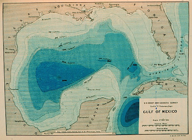
Bathymetric Map
This is an example of a Bathymetric map. Bathymetric maps are used to represent accurate information of the submerged terrain. It is just the opposite of a topographic map. The topographic maps are used to show the terrain from an uphill angle.
No comments:
Post a Comment
Newer Post
Older Post
Home
Subscribe to:
Post Comments (Atom)
No comments:
Post a Comment